Saturday, September 11, 2010

HOME SWEET HOME


Well, we finally made it home.  We have seen wonderful places, and will forever remember this trip.  We would like to thank all of our followers for spending 99 days and traveling 9,878 miles with us.  It was great seeing how beautiful our great country is, enjoying interesting sites, and spending time with friends, and meeting interesting people.  We hope all of you had an enjoyable summer as we did.  It's time to start planning next summer's trip.

Judy & Mike

Tuesday, September 7, 2010

ZION CANYON NATIONAL PARK, UT

We arrived at Zion Canyon Campground mid-afternoon, set up, ate lunch and had a restful afternoon.  The temperature kept climbing the entire trip today. Last night at Bryce Canyon we had the heater on and the first thing we did when setting up today was plug in the electricity so we could turn on the a/c immediately.  It was close to 100°!  The next morning after another yummy breakfast we took off for Kolob Canyons, a portion of Zion National Park, 42 miles to the northwest where we have never been before.  We hiked the Timber Creek Trail which offered incredible views of the Finger Canyons.  At the end we were supposed to be able to see the rim of the Grand Canyon, but we don’t know whether we did or not since there was no signage pointing it out.  The temperature made it a little uncomfortable since it was in the high 90s, but there was a little breeze most of the time.  After our hike we enjoyed the picnic lunch we took with us.


The next morning we got up early, took showers, ate breakfast and walked to the bus stop right outside the campground to catch a bus to the Zion Canyon visitor center. There we walked to where the shuttles are and got on and went all the way to the end where we did our first hike of the day.


The Riverside Walk is the gateway to the Zion Narrows.   It is a 2 mile walk which took us a little more than an hour.  Since we were there rather early in the day it was nice and cool.  The canyon we walked in got narrower as we got closer to the end and the walls loom just about as high as you can see.  There were many people who rented walking sticks, waterproof sox and shoes so they could walk in the water.


We hopped on another shuttle which took us to Weeping Rock trailhead where we had a little snack we had brought along.  This hike was shorter and brought us to an overhanging blind arch where we got a little wet since it drips every day of the year.  The spring water seeping out of the rock 100 feet overhead takes nearly 1000 years to travel through the porous Navajo sandstone above.  We remember there was more seeping the last time we did this hike. The cool water actually felt good.


Then back on a shuttle to catch a ride to the campground where Mike took a nap and Judy read until dinner time.  Another fun day in Zion!


Saturday, September 4, 2010

RED CANYON STATE PARK & BRYCE CANYON NATIONAL PARK, UT

RED CANYON

We arrived at Bryce Canyon Pines Campground in Bryce, Utah.  After lunch in the trailer we headed to Red Canyon, which we hadn’t been to before.  It was only five miles from the campground.  We hiked the Pink Ledge Trail which had Bryce-like red spires and rock formations.  On this one-mile trail we saw totems, yucca, juniper, fir, ponderosa pine (its bark smells like a hint of vanilla or butterscotch), greenleaf manzanita and lots of pinnacles of pink, red and yellow colored hoodoos.  It was a warm, beautiful hike where the trail was cut into the side of the mountain, but we took it easy and survived!  We were told by the volunteer in the visitor center that there was one very steep section and we did what he suggested, which was to start at the other end so we would come down that part and make our knees work instead of climbing up and having our hearts and lungs do the hard work.  We were glad we listened to his suggestion.  Then we ‘did’ the Hoodoo Trail, which was very easy and short.  Judy went back to the truck and Mike did a little ‘photo’ trail that was also short.  Not having enough yet, Mike drove Dave’s Hollow Loop where we were told we would see lots of elk, but……..instead we saw a few deer.  The road was dirt and VERY rutted, but again, we survived!  The road was constructed for all terrain vehicles and snowmobiles.


BRYCE CANYON
 
We headed into Bryce Canyon National Park where we saw thousands of multihued hoodoos (pillars of limestone of fantastic shapes, left by erosion. No where else in the world can one find a concentration of pinnacles with odd shapes like those found in Bryce Canyon.  The Paiute Indians thought these to be the petrified remains of the ‘legend people,’ turned to stone for their evil ways and frozen in time forever.  Besides the hoodoos we also saw natural bridges, the amphitheater, valleys, plateaus, mountains, canyons, wildflowers, arches, forests, and even some layers of cap rock that hadn’t been eroded yet. It is an amazing park to visit and it can all be done in one day if need be since it only 56 square miles.


W E   W I S H   E V E R Y O NE   A N   E N J O Y A B L E 
L A B O R   D A Y   W E E K E N D

Tuesday, August 31, 2010

ESCALANTE, UT

Our first stop today was Utah’s Anasazi State Park Museum where we learned about the Anasazi.  These village-dwelling farmers existed in the southern Colorado Plateau of the Four Corners region of Utah, Colorado, New Mexico, Arizona, and southern Nevada between about A.D. 1 and 1300.  We watched a movie and viewed the exhibits in the museum before walking outside to see the 6 room replica and the excavation.  Major excavations were undertaken here by the University of Utah in 1958 and 1959 which uncovered 97 rooms, 10 pit structures, and hundreds of thousands of artifacts.  We were able to see outlines of unexcavated rooms and a reproduction of one L-shaped above-ground building.


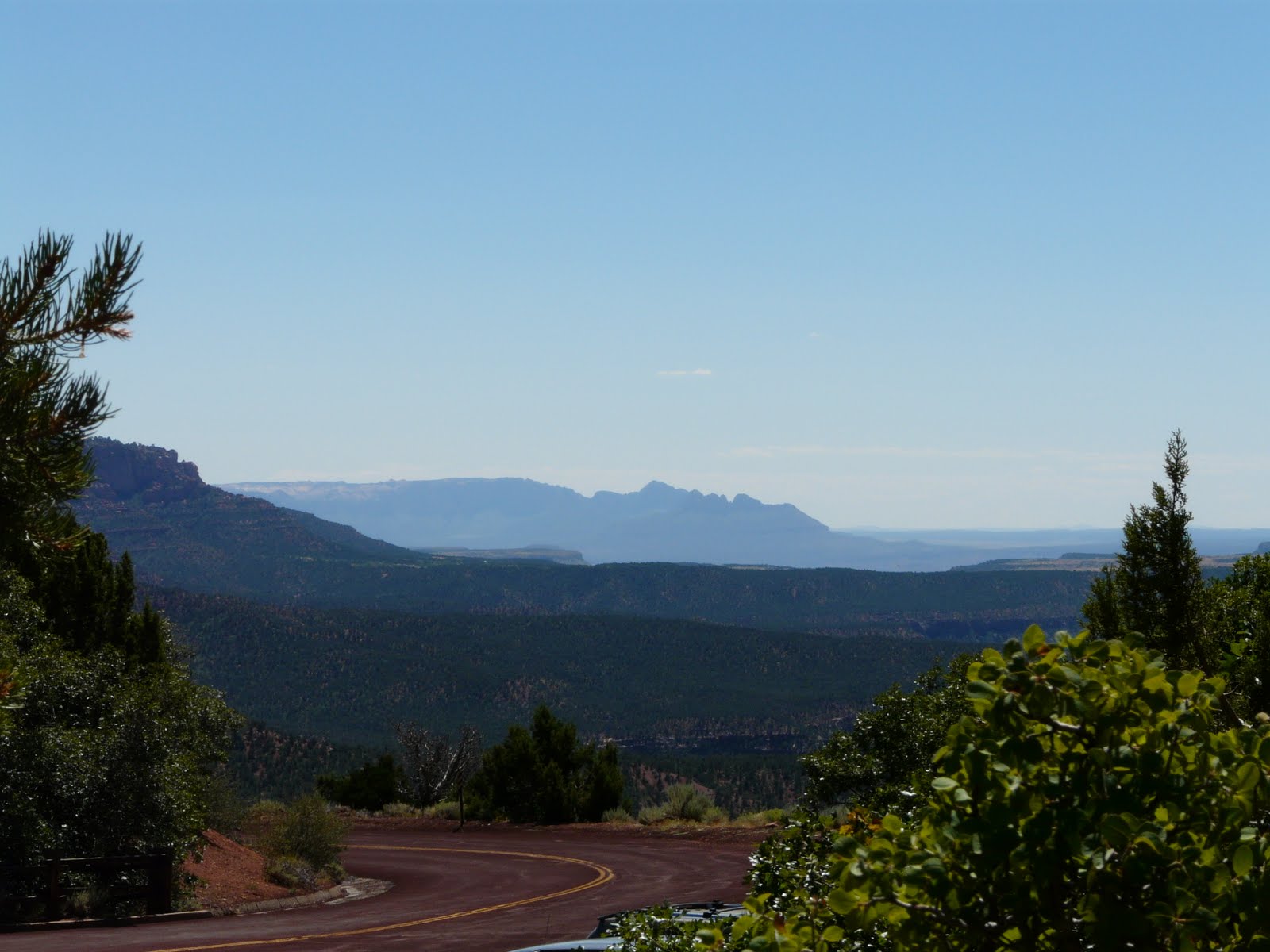
Then on to Utah’s most recent addition to protected lands by President Bill Clinton’s proclamation in 1996, The Grand Staircase-Escalante National Monument.  The monument is partly named for the Escalante River Canyons which begin on the edge of Boulder Mountain and end at the Colorado River. When early geologists saw the cliffs and plateaus rising 6,000 feet from the north rim of the Grand Canyon to Bryce Canyon, they called it the Grand Staircase.  We saw huge expanses of red-orange canyons, cliffs, rivers, and high-desert plateaus.


The next day we drove Hell’s Backbone, a road that is considered one of the most dramatic stretches of road in Utah as it travels along a ridge with a sheer drop on both sides.  It is gravel and only about one and a half lanes wide.  We started the 45 mile loop and at the beginning we saw the same scenery we saw as we drove into Escalante yesterday.  Four deer were spotted enjoying a stroll thought the trees and we were lucky enough to get pictures and a video.  As we climbed the types of trees changed (near the top we even saw Aspens that were changing color already) as did the fact that the road narrowed even more and there were drop-offs on at least one side if not both and they were SHEAR drop-offs!  Judy was NOT comfortable.  When we approached the ‘top’ of this climb we arrived at Hell’s Backbone Bridge which spans a crevasse on a narrow ridge no wider than the bridge itself.  This trip was VERY DRAMATIC and Judy was very relieved when we got back to ‘ground’ level!  The weather was perfect, at the top it was 63 degrees and in the mid seventies the balance of the day.